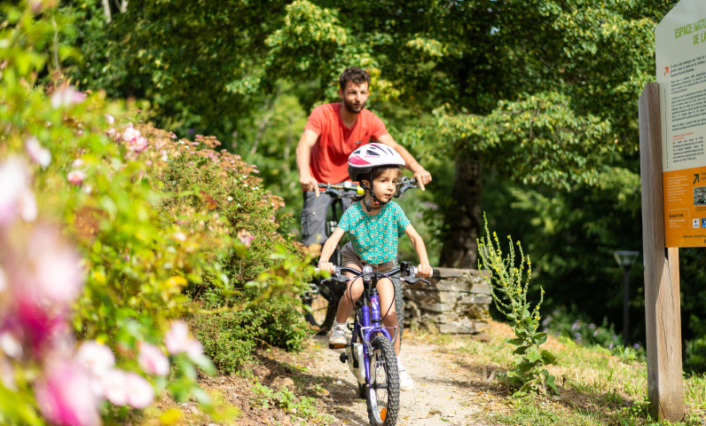
Hiking in Aveyron: Nature, Heritage, and Panorama
Discovering Medieval and Natural Heritage
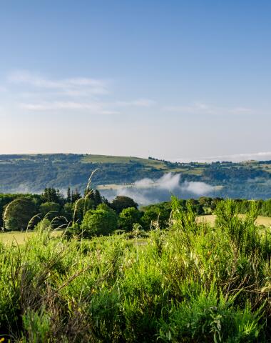
In the heart of Carladez, between rolling hedgerows and majestic peaks of the Massif Central, Mur-de-Barrez is the ideal gateway for hikes rich in landscapes and history. These trails offer an authentic immersion in a preserved nature, where paths wind through deep forests, glacial valleys, and panoramic heights.
Each route invites you to discover the local medieval heritage through charming villages and remarkable historical sites. Whether you climb the summit of Buron de Pleau for an exceptional view of the Monts du Cantal, Puy Griou, Puy Mary, and Aubrac, or follow the peaceful Bromme valley, the richness of this territory will surprise you.
Breathtaking Landscapes
Along the hike, let yourself be carried away by the beauty of the panoramas, the serenity of the Gardens of the Five Senses, and encounters with a still-authentic nature. Wildlife, flora, and cultural landscapes intertwine to offer a unique experience where humans and their environment are deeply connected.
A Complete Experience Between Emotions and Discoveries
Explore Mur-de-Barrez and its surroundings, where every step tells a story. These trails reveal the hidden treasures of Aveyron and provide a complete hiking experience, combining emotions, discoveries, and wonder.
Hiking trails in Thérondels
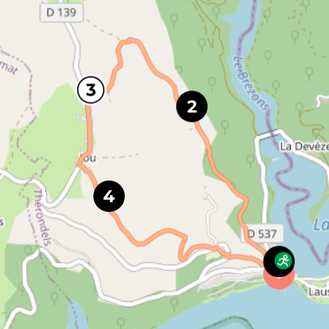
The trail of Jou
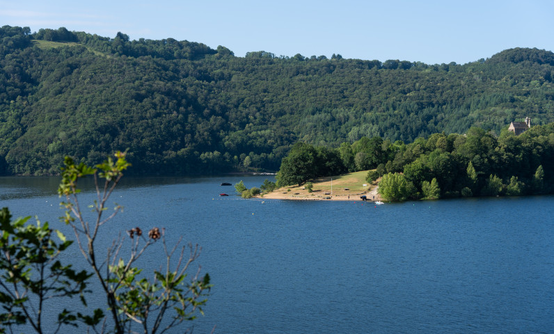
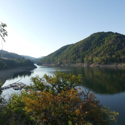
Discover the Presqu’île de Laussac, a jewel of Lake Sarrans, through a short hike that will make you “take height” to enjoy exceptional viewpoints over the Sarrans reservoir and the hamlet of Laussac. A refreshing swim is possible in summer, rewarding your efforts.
- Starting commune: Thérondels
- Starting point: Presqu’île de Laussac (site entrance)
- Themes: Water, Wildlife
- Route type: Loop
- Duration: 1h15
- Distance: 4.8 km
- Difficulty: Moderate
Itinery
Step 1
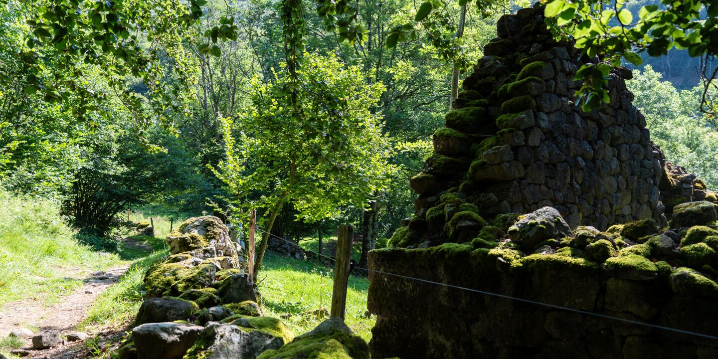
From the parking area, return toward the exit of the peninsula and the D537 road. At the crossroads, take a left for a few meters. At the transformer station, make a sharp right onto a steep path. Pass through a chicane and climb through the woods along an old path still lined with stone walls in places. At the first fork, go through a second chicane. Continue straight uphill until you reach a pasture.
Step 2
At the entrance of the pasture, pass another chicane and ascend slightly to the left toward the abandoned barn of Borie de Mathieu. About 40 meters below the barn, find a grassy path bordered by two large ash trees and rejoin the old service road. Continue onto a forest track and take it to the left. At the next crossroads, continue climbing left through the woods. Reach the plateau and emerge onto a service road near the TV relay station. Follow it to the right until you reach the D139 road.
Step 3
Turn left and head toward Jou. In the hamlet, near a farrier’s work area (this frame was used to hold oxen still while shoes were nailed to their hooves), turn left and then right onto a farm track for about 350 meters.
Step 4
At a fork, take the right-hand hollow path, which offers views of the lake during the descent. Exit onto the D98 road at the Borie d’Andrieu crossroads. Cut across the bend and rejoin the D98 lower down. Turn left onto a steep path with breathtaking views of Laussac. Rejoin the road and continue to the village.

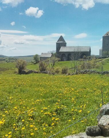
The Templar village of Nigresserre
Discover an ancient Templar commandery with this easy hike across a lush plateau. This circuit offers clear views of the Plomb du Cantal to the west and the Aubrac to the east, perfect for lovers of grand landscapes. On the way back, take time to admire the majestic hollow lime tree over 400 years old, a true natural monument.
- Starting town: Thérondels
- Starting point: Hamlet of Nigresserre, in front of the church
- Themes: Agriculture, Flowers/Plants, History and Heritage
- Type of route: Loop
- Duration: 2:15
- Distance: 8.4 km
- Difficulty: Easy

Itinery
Step 1
From the fountain, take the small road to the right leading to the cemetery. After passing it, continue on a wide farm track bordered by pastures and tall ferns (views of the Monts du Cantal and the slopes of the Plomb). This circuit wanders through the pastures up to the Carladez Aviation Camp (an unusual encounter). After the hangar housing the aircraft, emerge onto the road coming from Ladinhac.
Step 2
Continue left to Douzalbats (traditional buildings, 16th-century chapel with a basalt holy water font). At the entrance to the village, turn left and climb to the church. From the square, continue along the small road leading to the cemetery. Pass in front of the entrance (impressive funerary monuments inside). At the corner formed by the enclosure wall, turn 90° right and follow a grassy path bordered by dry stone walls. Emerge onto an agricultural path.
Step 3
Turn left and follow this path to the Maison Neuve farm (a major typical plateau farm with modern agricultural buildings adjacent to old local slate-covered structures). Go around the farm on the right. On the small service road, continue left for 150 m.
Step 4
Make a hairpin left onto a grassy path returning towards the farm for 60 m. Turn right and follow a path bordered by hedges for 1 km, used by herds to reach the pastures. At the first crossroads, turn left then immediately onto a wide path leading to the D 575 road. Continue left on the road to come back at the Nigressere church

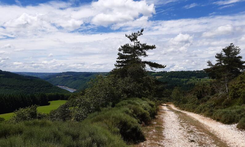
Laussac peninsula
From the village of Thérondels, near the Monts du Cantal, this challenging hike takes you through the wild gorges of the Truyère and along the Sarrans reservoir. The circuit is distinguished by its physical demands and breathtaking panoramas, offering exceptional views over the region.
- Starting point: Thérondels
- Departure location: Parking lot at the Thérondels Town Hall
- Themes: Agropastoralism, Water, Viewpoints, Top 3 Aveyron
- Type of route: Loop
- Duration: 4h45
- Distance: 14.8 km
- Difficulty: Difficult
The hiking trails in Taussac
The moors of Mayrinhac
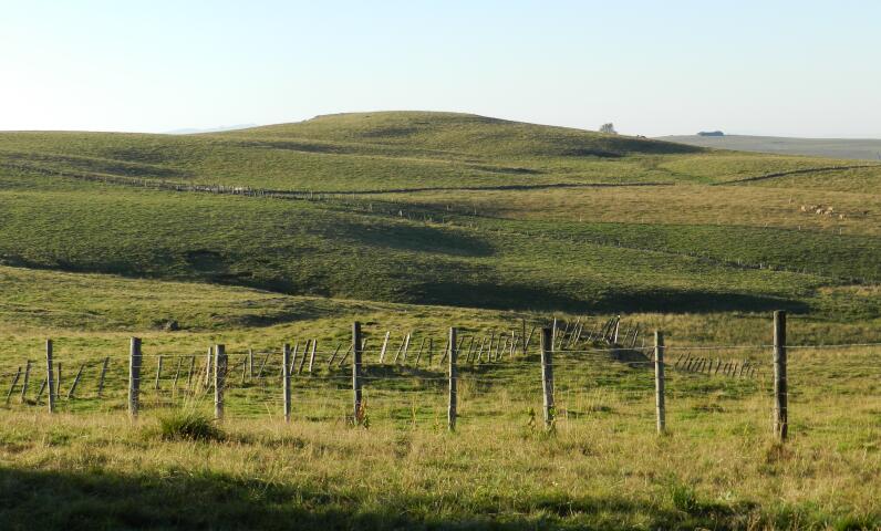
Enjoy a unique immersion in the heart of the Bromme gorges, on a discovery trail set within a Protected Natural Area (ENS). This remarkable site features a rich and varied landscape mosaic: heaths, meadows, fields, forests, cliffs… all environments that support an original and valuable biodiversity.
Birdwatchers will be delighted by the presence of prestigious birds of prey such as the Red Kite, the Booted Eagle, the Honey Buzzard, the Short-toed Snake Eagle, and the Eurasian Eagle-Owl. But the wildlife doesn’t stop there: many remarkable insects like the Stag Beetle, the Orange Tip butterfly, and the Brimstone butterfly also inhabit the site. The most attentive may even hear the calls of the Midwife Toad.
The village of Mayrinhac, typical of Carladez, completes this outing with its well-preserved heritage: restored farmhouses, a church housing nearly 1000 relics, a communal bread oven, and a calvary.
- Starting town: Taussac
- Starting point: Mayrinhac church square
- Themes: Water, History and heritage, Viewpoints
- Route type: Loop trail
- Difficulty: Very easy
- Duration: 1:30

Itinerary
Step 1
Welcome and information panel of the Protected Natural Area. In front of the panel (back to the church), head left for about 100 m, then turn right onto a farm track leaving the village and passing alongside crops.
Step 2
After leaving the plateau and meadows, the path continues along the hillside (see the electricity transport installations and the Bromme dam), crosses heathland and offers views of the cliffs.
Step 3
At the intersection, take the right path that climbs toward the "Cabane du Roucagnou."
Step 4
Continue straight ahead (leaving the small path on the left) on the path that goes back up to the plateau.
Step 5
Follow the path to the left to reach the village of Mayrinhac (view over the village) and the parking lot.
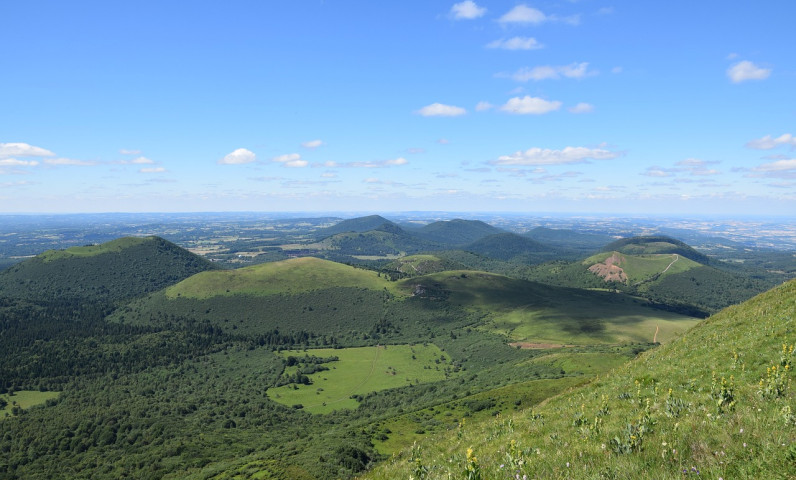
The site of Ronesque
For a contrasting experience, the hike at the Ronesque site first invites you to feel the tranquility of an old forest, before reaching the basaltic mesa of Ronesque. This flat-topped plateau with steep slopes is an impressive witness to past volcanic activity in the Cantal region. From up there, enjoy a 360° panorama of the surrounding landscapes.
This circuit alternates between dense forest, wild valley along a stream, and ascents to reach the summit.
- Starting town: Taussac
- Starting point: In front of Taussac church
- Themes: Flora, Geology, Viewpoint
- Route type: Loop
- Difficulty: Difficult
- Duration: 04h01

Itinerary
Step 1
From the church square in Taussac, head back towards the calvary. Pass to the left and follow wooden signs for the “Sentier de l’Imaginaire”. Pass in front of the castle. Follow a gravel path to the Borie-Basse farm. Turn right at 90° onto a dirt path through the woods toward the valley. At the hermit’s hut, cross the stream (footbridge) and climb 50 m up to a track.
Step 2
Follow the track to the right (Sentier de l’Imaginaire – The Magic Forest climbs left back towards Taussac). Cross two small streams. Continue left along the Combellou stream and follow directions to Lez / Ronesque. After three forks (two right: Messilhac / Mur, and one left: Notre-Dame de Lez), sometimes along the stream, sometimes overlooking it, reach the Pesturie road then the hamlet by continuing left.
Step 3
Go straight ahead. Cross the Goul and immediately after, turn right onto a fairly steep gravel path climbing through the woods towards Ronesque (1 hour climb). Reach a small road near recent farm buildings. Follow it left to climb onto the basalt peak (orientation table, unique 360° panorama, church cemetery). On the way back down from the peak, descend left on a rocky path to the “end of the world” village of Ronesque.
Step 4
Turn left to cross the village. At the last house (very typical), continue left to descend through the woods to the confluence of the Goul and Rasthène at Bazaygues. Cross the two streams. After the second bridge, veer right. Climb up to Serres via a fairly steep forest track with switchbacks.
Step 5
Follow the road left for 400 m. At the first bend, turn left onto a dirt path bordered by walls or basalt blocks that continues as a farm road to Lugat. After the first house, turn right onto a service road joining the D 13. At the crossroads, go straight onto a dirt path then a hollow path to Taussac. (Rejoin the Sentier de l’Imaginaire).
Hiking trails in La Croix-Barrez

Valon, the stream of Alcuéjoul
Discover a short but exceptional hike along the slopes of a wild valley, where a rushing stream flows under the watchful protection of the Valon castle. This trail offers you a unique view of this remarkable natural site, combining history and preserved landscapes.
- Starting town: Lacroix-Barrez
- Starting point: At the entrance of the village of Valon, Lacroix-Barrez
- Themes: History and heritage, Viewpoint
- Route type: Walking loop
- Difficulty: Medium
- Duration: 1h40
Itinerary
Step 1
From the entrance of the village of Valon, return to the D 97. At the crossroads, go down to the left for 150 m until an old house. Make a sharp right turn onto an old path and descend to the stream. Climb up to the La Fargue farm (steep trail).
Step 2
At the farm, turn right (direction Rouens), continue on a level "carral" (woodland path) overlooking the Alcuéjoul stream. Emerge onto a small road coming from Rouens.
Step 3
Follow it to the right until Gally (restored farm). Cross the stream. Climb back to the D 97. Continue right for 350 m until the Durand farm.
Step 4
Turn left onto a grassy path. Follow it along the slope and reach the wooden cross at the top of the village (magnificent views of the castle, the old village, the church, the Truyère gorges, and the Saut du Chien waterfall). Continue descending to the parking.
The castle of Valon
From the picturesque perched village of Valon, perched on a rocky spur, embark on a sporty hike rich in panoramic views over the wild gorges of the Truyère. Few places allow you to get so close to the Truyère River within a protected area designated as a Natura 2000 site. Here, your steps will be accompanied by local birds of prey: kites, booted eagles, and peregrine falcons nesting in these preserved gorges.
The route starts at the entrance of the village, ascending towards the castle and the old slate-paved square, then follows an ancient path lined with dry stone walls, passing typical small farms, before reaching several impressive viewpoints over the valley and the reservoir. The walk also crosses varied landscapes, including woods, pastures, and restored hamlets, with the possibility of short detours.
- Starting town: La Croix-Barrez
- Starting point: Entrance of the village of Valon (lower parking)
- Themes: Architecture, Water, History and Heritage
- Route type: Loop
- Difficulty: Medium
Duration: 04h00
Hiking trails in Argences-en-Aubrac
The Cross of Cayre
An easy hike with no elevation change that takes you across the typical droving paths of the Aubrac, discovering a small exceptional heritage and a gem of Romanesque art. The route offers open views and peaceful landscapes, with panoramas over the Viadène plateau and the Roc du Cayla (1298 m).
- Starting town: Argences-en-Aubrac
- Starting point: Village square, Alpuech
- Themes: History and Heritage
- Route type: Loop
- Difficulty: Easy
- Duration: 1h30
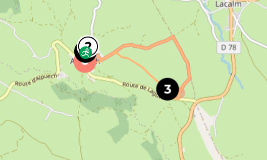
Itinerary
Step 1
From the village square, take the road to Vitrac-en-Viadène for about 100 m. At the exit of the village, after the farm buildings and at the cross, turn right. Pass the cemetery. At the first intersection, turn left and follow this road which becomes a track up to the Croix du Cayre (altitude 1116 m).
Step 2
At the Croix du Cayre, take the draille (path used by herds during transhumance) on your right. Follow this draille then, at the crossing, take the track going right. Join the D 34 and follow it to the right for 150 m.
Step 3
Take the first track on your right and follow it. At the crossing, turn left, pass the buron de la Ponchona (“of the needle”) and reach the village of Alpuech.
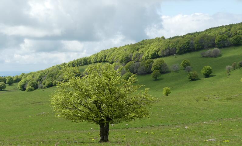
The Plos
A pleasant walk that offers a great gain in elevation in the heart of the typical Aubrac landscapes. You will enjoy a 360° view, from the Cantal mountains to the Aubrac plateau. In spring, this route is a flowery rendezvous with orchid meadows, followed by the iconic yellow gentians.
- Starting town: Argences-en-Aubrac
- Starting point: Village of Lacalm
- Themes: Flora, History and heritage
- Route type: Loop
- Difficulty: Easy
- Duration: 1h30

Itinerary
Step 1
At the exit of the village of Lacalm, towards Chaudes Aigues, opposite the livestock market, you will find a stele with a statue: that of Clairon Rolland. From the Clairon Rolland stele, follow the road to the right until the village exit sign, then take the small road to the right towards "Sessières."
Step 2
Just before the hamlet of Sessières, leave the road and take the track that climbs to the right. Follow this track to the junction with the D 165. Take a left onto the road, then the first steep track on the right. On the heights, enjoy a magnificent view of the Cantal mountains.
Step 3
Arriving at the road (D 165), take a right, then the first "draille" (path used by herds) that climbs on your left. Follow this draille to the village of Lacalm while admiring the sublime panorama over the village, the Truyère valley, and the Cantal mountains.
The Landscaped Paths
Starting from La Terrisse, this easy hike winds through the gentle rolling landscapes of the Viadène. After a descent into the wooded valley of the Argence, you will cross hamlets and pastures while enjoying a peaceful atmosphere. The highest point at Prats Nals, at 1027 m, offers a superb panorama over the valley of the Truyère and the iconic peaks of Plomb du Cantal, Puy Griou, and Puy Mary.
- Starting town: Argences-en-Aubrac
- Starting point: In front of the church of La Terrisse
- Themes: Viewpoints
- Route type: Loop
- Difficulty: Easy
- Duration: 2h00

Itinerary
Step 1
From the church square, take the small road “du Quié” passing between the Virgin statue and the fountain. Follow this road for a long stretch; after the last house, the road turns into a path. Continue along the path until you reach the stream "l'Argence Vive."
Step 2
Cross the Argence Vive stream, then 200 m further at the intersection with a farm track, turn left. Follow this path for 300 m, then turn left again at a wooden cross to return toward the stream. Cross the stream and continue on the path to climb back up to the plateau.
Step 3
At the road, turn left towards the Plaisance farm. Pass this farm and continue towards the Cazals. After the Cazals farm, take an old road to the right. On the plateau, at the first fork, take a right, then at the second, a left, and at the third, straight ahead until the junction with the road (D 34), offering beautiful views of the Cantal mountains and the Carladez plateau.
Step 4
Take the D 34 to the right for 100 m. Then turn left onto a farm track. At the first intersection, turn right, then at the second, left. When you reach a small road, turn left, then at the second intersection, turn left again to return to the lower part of the village of La Terrisse.
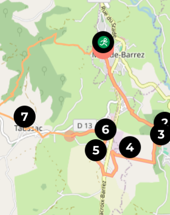
Hikes in Mur-de-Barrez
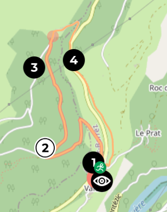
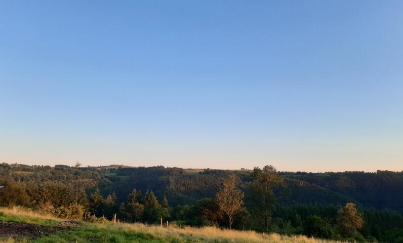
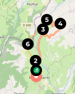
The Buron of Pleau
Set off for a hike to the summit of Carladez, with an exceptional viewpoint over the Monts du Cantal. From the medieval village of Mur-de-Barrez, reach the Buron de Pleau perched at the top of its “mountain.” At the summit, admire the majestic panoramas: Plomb du Cantal, Puy Griou, and Puy Mary unfold to the north, while the Aubrac stretches out to the east. On the way down, stop at the village of Taussac and discover its charming garden of the 5 senses, a place where heritage and nature perfectly harmonize.
- Starting town: Mur-de-Barrez
- Starting point: Parking du Forail, Mur-de-Barrez
- Themes: Flowers / Plants, History and Heritage, Hiking
- Route type: Loop
- Difficulty: Medium
- Duration: 4h00
Itinerary
Step 1
From the Corette parking, pass the REVEO electrical post on your right and head straight toward Rue de la Briqueterie. At 400 m, turn right onto Avenue du Cardinal Verdier. At the next junction, follow the D904 toward Lacroix‑Barrez, crossing at number 52bis, then turn left at the first intersection toward Pleau. At the bend, head toward the La Sapinière subdivision, skirt it, and descend to the path at its end. Follow the path to reach the hamlet of Pleau.
Step 2
At the entrance sign, cross the road and take the trail on the left for 50 m. Cross the road again and follow the paved track toward the Fitness Center.
Step 3
Enter the wood via the trail slightly to the right (behind the Fitness Center). After 20 m, veer right (360° icon) onto the ascending trail. Ignore the next two trails on the left and continue right downhill. At the junction, take the trail on the left (360°) uphill. At the bend’s entrance, keep left to exit the woods. Walk alongside the pasture toward the fir grove and the buron at the top of Pleau mountain. At the Buron, behold the Monts du Cantal (Plomb du Cantal, Puy Griou, Puy Mary) to the north, the village of Mur and Château de Venzac in the foreground, and the Aubrac ranges to the east.
Step 4
Descend from the buron via the track toward the D904. Before reaching the department road, turn left onto a path through trees past the EDF building. Stay left at the junction and skirt the subdivision along the paved lane toward the D904, cross it, and immediately take the small road to the right below. Pass through the hamlet of Cancelade (noted for its beautiful old houses).
Step 5
At the exit of the hamlet, keep left at the junction and continue on the minor road for 300 m. At the bend, make a 90° right onto a sunken path up to the subdivision, then turn left toward the Equestrian Center.
Step 6
Facing the center, descend the track left to the minor road, then turn right toward the village of Taussac. At the village entrance, follow the main road left, then at the junction opposite the calvary, turn left onto a paved road (approx. 100 m). At the next junction, turn right, cross the main road toward the church. Past the church (20 m), take the alley on the right climbing toward the House of Wood, walking beside it on a grassy trail.
Step 7
At the next fork, veer left onto a sunken path (Sentier de l’Imaginaire in reverse – pyro‑engraved wooden signs). Enjoy beautiful views of Mur-de-Barrez and the Monts du Cantal. Descend into the woods toward the green theater, then follow the stream to the footbridge. At the barrier (with a sculpted wolf), descend along a wide track to the stream, then follow the GR465 trail (red & white blaze). Continue ascending on the GR via Le Verdier, then turn left toward Mur‑de‑Barrez. You emerge on Monaco Square (shops, cafés), pass the CIC bank, and in front of the Monaco Tower, take Faubourg Street on the right, climbing back to the Corette parking.
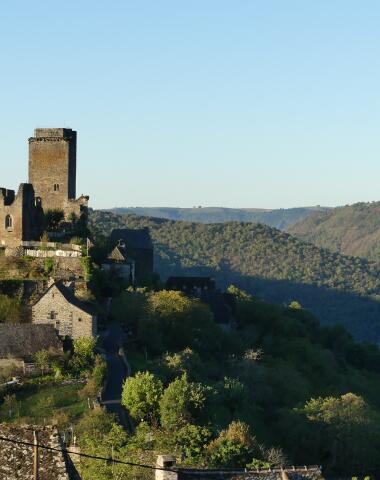
The Bromme Valley
A walk through the heart of an ancient glacial valley, now traversed by the rushing stream of the Bromme. This route immerses you in a typical mid-mountain landscape, between rolling farmland and panoramic ridges. The trail follows an old Cluniac route linking Bredons to Conques, with remarkable cultural landmarks: the Château de Venzac, the village of Brommes, and its Romanesque church adorned with exceptional crosses and modillions. You’ll return to Mur-de-Barrez, a medieval town with a rich history, once owned for over a century by the Grimaldi family.
- Starting town: Mur-de-Barrez
- Starting point: Parking de la Corette, Mur-de-Barrez
- Themes: Agropastoralism, History and Heritage
- Route type: Loop
- Difficulty: Medium
- Duration: 4h00
Itinerary
Step 1
From the Monaco Tower (Clock Tower), head north via Rue de la Parro toward the D900 (direction Raulhac). After 500 m, turn left to take a metal staircase, then a small road leading to a major junction at Côte Blanche.
Step 2
Turn right onto the D575 toward "Nigresserre". Pass the Marot farm and cross the Bromme river. After 250 m, turn onto a grassy (sometimes muddy) path toward Venzac Castle. In front of the castle’s main entrance, continue straight ahead. Emerge onto a small road leading to Yolet. Turn right and climb up to the hamlet (beautifully restored traditional houses).
Step 3
After the last house, leave the road to Bex on your left, and climb right via a stony path up to the ridge. At the first junction, turn right for 300 m. At the next junction, continue left along a ridge path lined with hazel trees for 1 km.
Step 4
At the water reservoir (great views over the Monts du Cantal), continue left on Route de la Salesse for 300 m. Turn left onto a farm track between fences. Descend into the valley. After three hairpin bends, pass the Bex farm on your left. Continue through the woods to the Bromme river. Cross the footbridge and climb to the village of Brommes (beautiful Romanesque church dedicated to St. Martin; the portal arch is decorated with billet molding).
Step 5
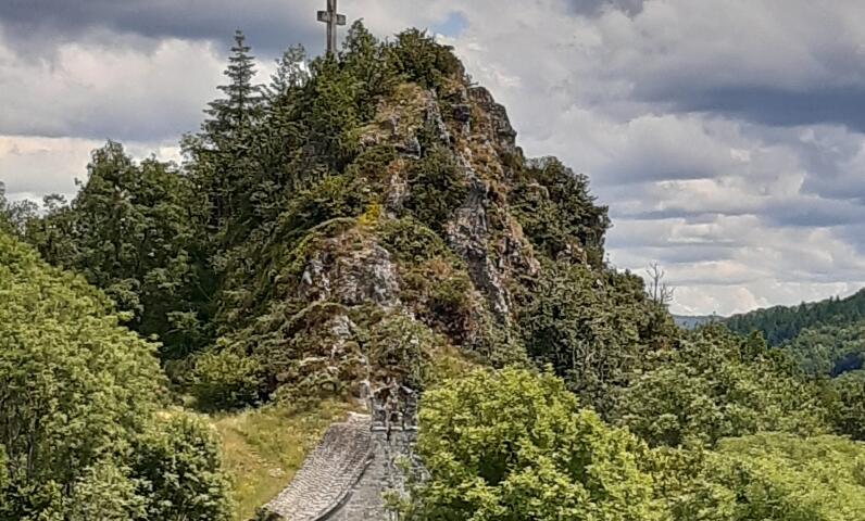
Continue on the D73 southwest. Turn right, climb to the cemetery entrance, then follow a path to the Puech de la Garde road. Turn left, then right onto a wide gravel track heading into the woods. In the forest, turn right onto a steep dirt track and do a 20-minute round trip to the Clauzades basalt promontory and calvary (spectacular 360° views of Cantal, Aubrac, and the Carladez plateau). Return and continue right on a narrower (sometimes muddy) path. At the first junction, turn sharply left and follow a hollow way and open path for about 1.3 km.
Step 6
At the next junction, turn left onto a wide track leading to the Puy de la Justice (panorama over Mur-de-Barrez and the Goul valley). Then descend to the starting junction. Return to Mur-de-Barrez via the small road and the staircase used earlier.
Want adventure and discoveries?
Embark on a journey along the Sentiers de l’Imaginaire and let yourself be guided through unique landscapes, fascinating heritage, and breathtaking panoramas.
Discover all the trails, their secrets, and practical tips on our dedicated page!
Get your hiking boots ready and dive into the adventure!